Posts

Showing posts from August, 2023

No. 1387 - Hobart - The Berea Chapel, Sabbath School and Hall (1831)

Image
The Berea Chapel and Sunday School was one of the earliest places of worship built in Hobart. It was located at the corner of Liverpool and Berea Streets, on a site now occupied by the Hobart PCYC. The last remains of the chapel were demolished in the early 1960s when a new building for the Hobart Police Boys Club was built. The chapel, which was constructed in 1831, came to be known as the ‘Berea Chapel’ and ‘Sabbath School’. It was named after the town of Berea, visited by the Apostle Paul, who found its citizens to be “open-minded” and “willing to received God’s message”. At the Chapel’s Sunday-school centenary celebrations in 1933, an article in the Mercury attributes the name of the building to one of its founders who had attended a chapel of the same name in Wales: “Over a hundred years ago a little lad in a Welsh village was one of the worshippers at a small chapel which, in keeping with the custom of an age of glowing faith and daily familiarity with the pages of Holy Writ, w

No. 1386 - Impression Bay - Church of Christ Meeting House (1889-1916)

Image
The Tasman Peninsula was the site of several Church of Christ communities who established churches or ‘meeting houses’ at Nubeena, Koonya, Highcroft, Oakwood and Impression Bay. The church at Impression Bay began in 1879 when William Spaulding moved into the area from Bream Creek. Worship initially took place in Spaulding’s home. In 1889 a small chapel was built on land donated by George Greatbatch. This was located on Cooks Road, midway between Impression Bay (renamed Premaydena) and Nubeena. There is little information about the church in its early years, however, in 1893, a lengthy article was published in the Hobart Mercury concerning the Church of Christ’s summer picnic. The report, which is reproduced below, provides a rare glimpse into the lives of the local Christian community: “The New Year's holiday was generally observed as such by sports at Taranna in the form of small shooting and fishing parties, and last, but by no means least, a general picnic was given by the memb

No. 1385 - Cygnet - Enjoy Church Huon Valley

Image
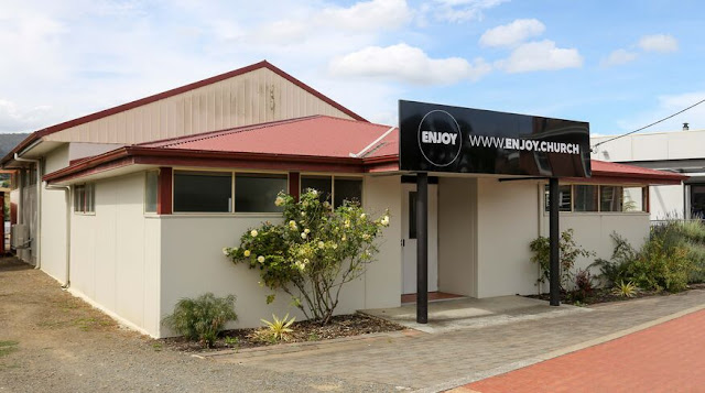
Cygnet is a small coastal town on the Channel Highway situated about 70 kilometres south of Hobart. It is named after the adjacent bay of Port Cygnet which was 'discovered' by D'Entrecasteaux and named ‘Port des Cygne’ (meaning the harbour of swans). The settlement was known as Port Cygnet until 1895 when it was changed to Lovett. In 1915 the town’s name was changed again becoming Cygnet The ‘Enjoy Church Huon Valley’ is located on Mary Street. It was previously known as the Huon Valley Christian Life Centre which dates back to 1985. The Enjoy Church was established in Melbourne in 1998. Historically the church has been associated with Australian Christian Churches, formerly Assemblies of God in Australia. The photograph used in this article was taken in 2023 by Derek Flannery for the “Australia’s Christian Heritage” website. Further photos of the church can be viewed in the link provided in ‘Sources”. Photographer: Derek Flannery-  “Australia’s Christian Heritage” website

No. 1384 - Tullah - Community Church

Image
Tullah is a small town on the Murchison Highway approximately 110 kilometres south of Burnie. It was established in 1900 as a remote mining settlement called Mount Farrell. In the 1970s Tullah was used by the Hydro Electric Commission to house workers engaged in the various parts of the Pieman River Power Scheme. At this time Tullah’s population peaked at 2500. The town is divided into two sections; the older northern mining settlement and the newer southern part developed by the Commission. Four churches were built at Tullah representing the Methodist, Catholic and Anglican denominations. These have all closed and in recent years were replaced by the Tullah Community Church. The Tullah Community Church appears to have closed in recent years. Further information about this former church is welcomed and I can be contacted through “comments” or through the ‘Churches of Tasmania” Facebook group. The photograph used in this article was taken in 2023 by Derek Flannery for the “Australia’s C

No. 1383 - Nubeena - "Wedge Bay Baptist Hall" (1892)

Image
Nubeena is a town on the western side of the Tasman Peninsula, approximately 13 kilometres northwest of the Port Arthur Township. Originally the town was named Wedge Bay. The Baptist church has had a minimal presence in South East Tasmania therefore it is unusual to find a Baptist community in such a remote location such as Nubeena. The construction of a Baptist church hall in 1892 was almost entirely the result of the efforts of Joshua Tovell Soundy, a Hobart businessman, who had purchased a property at Wedge Bay for use as a summer residence. Soundy was an active member of the Hobart Baptist church and played a prominent role in the construction of the Tabernacle on Elizabeth Street which had opened in 1887. In September 1892 the opening of the “Wedge Bay Hall” was reported by the Hobart Mercury: “A public hall has been erected at Wedge Bay by the Baptist community, with Mr. J. Soundy, of Hobart, as the mover and leader in getting the same done. The work has been carried out by loca

No. 1382 - Smithton Christian Fellowship (1994)

Image
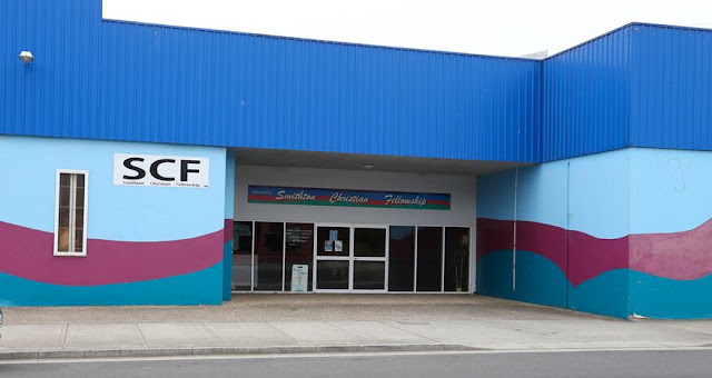
Smithton is the commercial and industrial centre of the Circular Head district in the far northwest of the island. The early settlement was known as Duck River but this was changed to Smithton in 1895. Smithton Christian Fellowship is a former community church located on Nelson Street. The church closed in about 2020 and its current status is not known. The church was established in 1994 and has operated at Smithton for about 25 years. The church’s denomination is not known. Further information Further information about this church is welcomed. I can be contacted through the comments or through the Facebook group "Churches of Tasmania”. Smithton Christian Fellowship - photographer: Derek Flannery (2023) Australia's Christian Heritage - see website listed below for further information Further Information https://www.facebook.com/smithtonchristianfellowship/ https://www.churchesaustralia.org/list-of-churches/locations/tasmania/directory/9748-smithton-christian-fellowship

No. 1381 - Smithton - Harvest Church Circular Head (2017)

Image
Smithton is the commercial and industrial centre of the Circular Head district in the far northwest of the island. The early settlement was known as Duck River but this was changed to Smithton in 1895. Harvest Church Circular Head is located in the former Uniting Church on Goldie Street. Worship is held in the old Uniting Church (Methodist) Hall situated behind the church. The ‘Harvest Church’ was established in 2017 at the “Gateway Church”. The first service was held in Smithton’s old Gospel Hall on King Street. The former Uniting church property on Goldie Street was purchased in 2021. The Harvest Church Circular Head falls within the pentecostal tradition although it is not known if it is affiliated with any of the national pentecostal churches. Further information Further information about this church is welcomed. I can be contacted through the comments or through the Facebook group "Churches of Tasmania”. Harvest Church Circular Head - Google street-view Further Information:

No. 1380 - Runnymede - Anglican Church (1860)

Image
Runnymede is a farming district on the Tasman Highway and is situated approximately 20 kilometres north of Sorell. It was previously named Brushy Plains until the present name was adopted in the 1840s. Runnymede was a 13000 acre property belonging to Askin Morrison, a prominent Hobart businessman and farmer. In 1860 the construction of a church was begun at Runnymede but this was never in completed. In May 1860 The Hobart Town Advertiser reported: “The attempt that was made some time since to erect a Church at Runnymede, has been so far successful, that the walls of a good and substantial edifice are contemplated. For the preservation of the masonry, however, if no other reason could be urged, if it absolutely necessary to roof the building without delay, or the storms of winter will totally undo all that has been done. It has been estimated that £100 will cover the cost of rendering the edifice impervious to wind and water, and it will undoubtedly sufficient for the the Trustees of t

No. 1379 - South Forest - St Stephen's Anglican Church (1935-1966)

Image
South Forest is a rural area in the Circular Head region and is situated approximately 15 kilometres east of Smithton. South Forest was settled around the turn of the 20th century. In 1911 a visitor to the area observed: “South Forest farmers are an industrious, hard working, contented community who, by dint of perseverance, thrift, and economy, generally manage to make both ends meet, and have a little to spare. In the majority of cases the holdings are private property, consequently the population is not a migratory one…”. Due to its relatively late settlement, South Forest only acquired a church 1930s. It was not a new building but the former All Saints' Anglican church located at Black River, which had been built in 1870. In June 1935 the Advocate reported: “A meeting of parishioners of the Church of England and those interested in the erection of a church for the Mengha district was held on Wednesday night at the residence of Mrs.W. H. Young, South Forest. Despite heavy rain t

No. 1378 - Bridgenorth - Anglican Church Hall (1913)

Image
This article is one in a series about public buildings in country areas that were used as places of worship. In these communities churches may have been planned but were never built due to lack of finance or changing circumstances. In most settlements, before a church was built, worship was typically held in homes, schoolrooms, barns, halls and other buildings. Conversely, in some communities, churches were sometimes the first public building erected and were used as schools and community halls. The focus of this series will primarily be on the public halls and schools that were used as churches. These buildings, and the religious communities which used them, are often overlooked in published histories of churches. Bridgenorth is a small community in the West Tamar region approximately 18 kilometres north of Launceston. It is centred on the junction of the Bridgenorth and Long Plain Roads. It is believed that the settlement’s name is derived from a town of the same name in Shropshire,

No. 1377 - Huonville - Kingdom Hall

Image
Huonville is a small town on the banks of the Huon River which is situated approximately 35 kilometres south of Hobart. Huonville’s Kingdom Hall is located on Voss Road off the Huon Highway. It is built in the style typical of most of the 21 Kingdom Halls established in Tasmania. No published information about the hall is available. The Jehovah's Witness diverges from the mainstream doctrines of Christianity in that it is a non-trinitarian tradition. Jehovah's Witnesses believe their denomination is a restoration of first-century Christianity. The historical persecution of members of the Jehovah’s Witness in many countries, including Australia, has further contributed to the denomination maintaining a low profile in the media. For this reason the history of the Jehovah Witness in Tasmania presents a challenge to research. The following information is derived from the Jehovah Witness’ official tract ''The Watchtower': “In the early 1900s a member of the International

No. 1376 - Mawbanna - All Saints' Anglican Church (1967)

Image
Mawbanna is a small community in the Circular Head region as is situated about 40 kilometres southeast of Smithton. The Arthur River forms the southern boundary of the Mawbanna district while the Black River forms a part of the western boundary. “Mawbanna” is an Aboriginal word for “black”. The last known thylacine to be killed in the wild was shot in Mawbanna in 1930. All Saints' Anglican church is a relatively recent addition to Mawbanna; opening in May 1967. However, the building is about 150 years old and has been moved several times. Its first location was on the west side of the Black River where it Erected in the 1870s. It was then moved to the east side of the river and a chancel was added at this time. In 1935 it was moved to South Forest where it remained before it was moved to Mawbanna. When it was moved to Mawbanna in 1967 a porch and vestry was added to the building. The history at the church at Black River and South Forest will be the subject of further articles on

No. 1375 - Swansea - Waterloo Point - Our Lady Star of the Sea (1864)

Image
Swansea is a small town located on the mid east coast about 150 kilometres from Hobart. The area was settled from the 1820s and was developed following the establishment of the Rocky Hills Probation Station 15 kilometres to the south. Between 1835-45 convicts from the Probation Station built roads through the mountains to Avoca and southwards to Hobart. In 1827 a military detachment established barracks at Waterloo Point, from which the early settlement derived its name. The settlement was later renamed Swansea, probably at the instigation of George Meredith, a prominent settler of Welsh descent. The early presence of the Catholic Church in the district was connected to the probation station at Rocky Hills. In 1855 Bishop Willson applied for a government grant of four acres at the junction of Wellington and Maria Streets. This did not proceed, as did a second request in 1860, for two acres of land, which included the former Commissariat Store at the abandoned military site at Waterloo

No. 1374 - Golden Valley - St Michael's Catholic Church (1896)

Image
Golden Valley is a rural area located approximately 16 kilometres south of Deloraine on the northeastern side of Quamby Bluff. The name “Golden Valley” appears to have been in use from the 1860s although the settlement was locally known as “The Bluff” for many years. The district was settled by a number of Irish families including the Donaghues, Bernes, Mahoneys and Hennesseys. In 1904 the Hobart Mercury's travelling correspondent visited Golden Valley which was briefly described in a series of articles titled ‘Notes From the North’: “This locality…may be reached by two different routes from the river town [Deloraine], though both ways are about the same distance. One road runs along the eastern bank of the Meander River for about four miles, and then turns off to the left, while the other goes past the Deloraine school. Along the former road there is very little habitation. Throughout the district Golden Valley is better known as the Bluff, for it is located at the foot of a mount

No. 1373 - Clarence Point - Methodist Church (1918)

Image
This article is one in a series about public buildings in country areas that were used as places of worship. In these communities churches may have been planned but were never built due to lack of finance or changing circumstances. In most settlements, before a church was built, worship was typically held in homes, schoolrooms, barns, halls and other buildings. Conversely, in some communities, churches were sometimes the first public building erected and were used as schools and community halls. The focus of this series will primarily be on the public halls and schools that were used as churches. These buildings, and the religious communities which used them, are often overlooked in published histories of churches. Clarence Point point is a settlement north Beaconsfield in the River Tamar region. It was once a significant orchard growing area. Little is known about Clarence Point’s Methodist church. In Max Stansall’s ‘Tasmanian Methodism 1820-1975’ the entry for the Clarence Point chur

1372 - Lower Turners Marsh - Wesleyan Methodist Church (1886-1888) "Disastrous Dissension"

Image
Lower Turners Marsh is a rural location north east of Launceston centred around the junction of the Pipers River and Bangor Roads. The development of Lower Turners Marsh progressed with the establishment of a slate mine at neighbouring Bangor in the 1870s. In 1884 the construction of a church at Lower Turners Marsh was proposed by John Thomason, an itinerant Methodist preacher. Thomason was a Shetlander who had started life as a sailor. Following his arrival in Tasmania he worked as a carpenter, mine manager, orchardist and a missionary. Thomason was successful in establishing several Methodist churches in the Greater Launceston region including Underwood, Patersonia and Lisle. In April 1884 the Launceston Examiner reported: “Mr Thomason…was at present labouring at Lisle, and lately they had a little success there….He appealed to the Launceston people for help in the matter of educating the children in his district. He was also, he said, trying to raise funds to build a church at the