Posts

Showing posts with the label 1900-1909

No. 1078 - Braeside Road Methodist Church (1905-1968)
Image
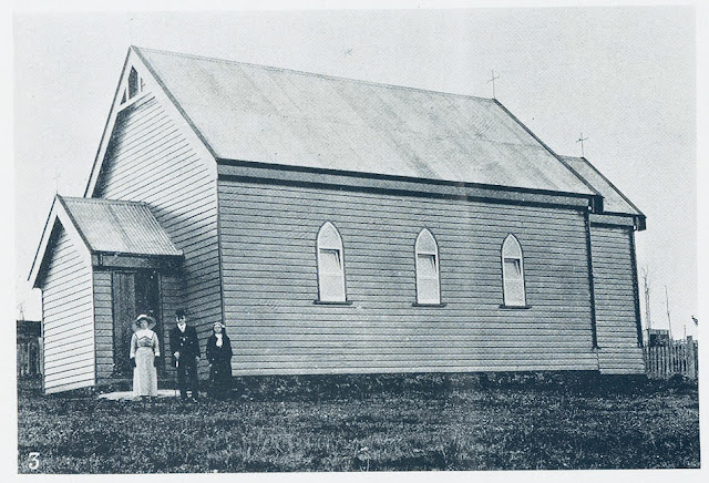
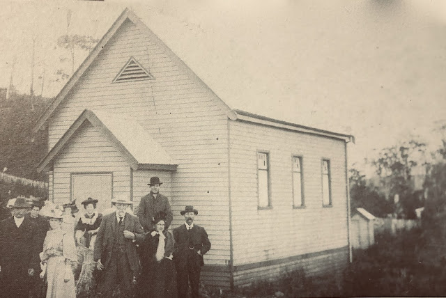
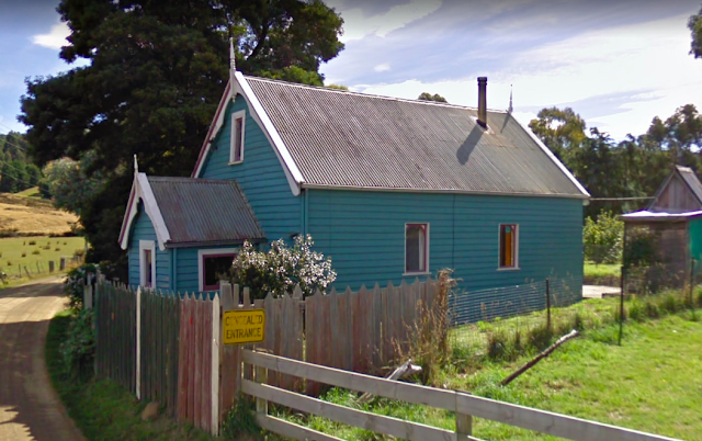
Braeside is a rural settlement in the Huon Valley, approximately 2 kilometres south of Franklin, centred along Braeside Road. Orcharding and saw-milling were the main industries in the area around the turn of the 20th century when the settlement had a school and church. Very little information is available about the former Braeside Road Methodist church. The following is recorded in Max Stansall’s ‘Tasmanian Methodism’: “During 1863 proposals to hold services in the area then known as Chitty’s Road were put forward. However it was not until 21/1/1897 that the first Trust meeting was held. The church-building was completed between 1900 and 1903 and a Sunday-school was operating some two years later. Evidently the Cause did not flourish for, on 1/4/1968, the Quarterly Meeting authorised the church’s closure”. A search of newspaper records provides a few further details about the church. In 1900 a report on the annual sessions of the Hobart Wesleyan District Synod records that permission...

No. 1017 - Hobart - St Peter's Hall

Image
St Peter’s Hall is situated within St Mary’s Cathedral precinct at the corner of Harrington and Brisbane Street. The building originally stood on lower Collins Street before it was dismantled and reconstructed at its present site in 1904. St Peter’s Hall was built in 1855 as a temperance hall and school house as well as for occasional religious services. It is marked on Jarman’s 1858 map of Hobart where it is listed as a Catholic chapel. Two 19th century ‘birds-eye’ views of Hobart (see below) clearly show details of the building which was accessed by a footbridge across the Hobart rivulet. Lower Collins Street fell within a district known as Wapping, which was one of Hobart’s poorer quarters located close to the docks. This article draws from newspaper accounts from the 1850s which describe the halls construction and opening as well reports from 1904 concerning its removal and reconstruction near the cathedral. The Colonial Times records the laying of the foundation stone of St Peter’...

No. 997 - Forest - The Forest Christian Centre

Image
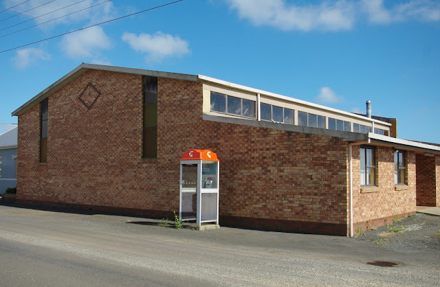
Forest is a small settlement off the Bass Highway about 12 kilometres south of Stanley in Tasmania’s far North West. The early settlers referred to the area as "the forest" and when an official name was needed it became simply "Forest". The Forest Christian Centre is situated at the intersection of Mengha Road and Backline Road. The church falls under the umbrella of the Association of Christian Community Churches in Victoria and Tasmania. The association describes itself as “a movement of like-minded local churches, predominantly of a Christian Brethren heritage, that have united under a common vision and mission, set of beliefs and core values”. The church was originally established as the Forest Union Church which opened in 1894. (This will be the subject of an upcoming article). The Union Church was to become the home of the Christian Brethren shortly after the turn of the 20th century. The original church adjoins the new hall which was constructed in the 1970s...

No. 993 - Smithton - Salvation Army Hall (1908-1909)

Image
Smithton is the commercial and industrial centre of the Circular Head district in the far northwest of the island. The early settlement was known as Duck River but this was changed to Smithton in 1895. Smithton is named after an Irishman, Peter Smith, who had been a constable, and later the licensee of ‘The Plough Inn,’ at Stanley. The Salvation Army first appeared at Smithton shortly after the turn of the 20th century. Over a period of about 70 years the Salvation Army built three halls at two sites; both on Nelson Street. The first hall, which was built in 1908, is the subject of this article. In September 1908 the Launceston Examiner reported: “About 2, years ago the Salvation, Army sent officers to Smithton with a view to starting their cause here. They soon gained followers, and last Sunday had the satisfaction of opening their new barracks, which was done by Staff-Captain Glitheroe and Officer Hammond. Three service were held, and at the conclusion of the evening service picture...

No. 989 - Glenlusk - St Barnabas' Anglican Church (1900-1945)

Image
Glenlusk is a rural district north of Collinsvale and which falls within the boundaries of the City of Glenorchy. A description of the area in the 1890s sets the scene for the story of St Barnabas’ Anglican Church: “This lovely spot is situated about 10 miles from Hobart. Proceeding by a steep but excellent road from Berriedale, the traveller finds it nestling on the top of the range dividing the valley of the Derwent from Sorell Creek. Here a magnificent panoramic view is obtainable,…the view needs being seen to be fully appreciated. From here the road divides into two, the one to the left proceeding to Bismarck where many foreign languages are spoken…. The road to the right winds down the steep pass of Sorell Creek to Molesworth. The staple products of Glenlusk are apples and small fruit,…the inhabitants seem a most industrious people…”. One of these industrious inhabitants was George Arthur Waller, of Glenlusk House, derived from 'Luska' in Ireland and after which the distri...

No. 978 - Irishtown - All Saint's Anglican Church (1907-1979)

Image
Irishtown is rural community situated approximately 10 kilometres south of Smithton. The area was first settled in the late 1850s by Irish migrants when the area was known as Upper Duck River. Irishtown’s All Saint’s Anglican church was built in 1907 on a site between the village post office and the State school. It was a weatherboard building with Gothic stye windows made in Melbourne. The church was designed by the rector, Reverend G.W. Ratten and was built by Mr. W. Dale of Smithton while the stone foundations were laid by Mr Harris. The church seated about 125 people and included a chancel measuring 12 by 10ft., a nave 32 by 21ft. and a vestry and porch. The church’s foundation stone was ceremonially laid on Tuesday 18 June 1907: “A solemn and impressive ceremony took place on Tuesday afternoon at Irishtown on the site of the Anglican Church now being erected, when the Rev Canon de Coetlogon, rector of Devonport and Rural Dean for the North-West, in the absence of the Lord Bishop ...

No. 971 - North Hobart - Swan Street Uniting (Methodist) Church

Image
The suburb of North Hobart, as the same suggests, is on the northern fringe of the city. It has evolved into a mixed residential and commercial area since it was developed in the 1830s. Swan Street Methodist Church opened in 1905 as a new place of worship for a congregation which had previously met in a Wesleyan Methodist Chapel on High Street (now Tasma Street) [ see No. 966 ]. Plans were made to build the new church on Swan Street soon after the Methodist Union of 1902. Two foundation stones for the new building were ceremonially laid on Wednesday 7 September 1904. The first stone was laid by Mr William Freeman Brownell, a businessman and former alderman of the city. The second stone was laid by Mr Henry Smith Kirby, (Special Magistrate of the Children’s Court) on behalf of the High Street Street Sunday school children. The Mercury reported: “Mr. Brownell said he had very great pleasure in taking part in the ceremony……This structure was necessitated through the High-street building h...

No. 952 - Gormanston - St Cuthbert's Anglican Church (1902-1930)

Image
Gormanston is a former mining town located off the Lyell Highway, approximately 5 kilometres east of Queenstown. Once one of the larger mining towns on the west coast, Gormanston has slowly declined to the point of becoming a ghost town. The settlement was originally called Mount Lyell but was later renamed in honour of Viscount Gormanston who was Governor of Tasmania (1893-1900). At its peak Gormanston and neighbouring North Mount Lyell had a population of around 2000. The decline of mining activity has resulted in a steady and dramatic fall in the town’s population which was reduced to only 17 at the time of the last census. Three churches established a Gormanston (Catholic, Anglican and Methodist) as well as a Presbyterian church at nearby Linda. Regular Anglican services at Gormanston began in November 1898, supported by St Martin’s church at Queenstown, which had opened earlier that year. The Mount Lyell Standard and Strahan Gazette reported: “The Rev. Mr Edwardes, of St Martin’s...

No. 950 - Smithton - St Andrew's Presbyterian Church (1907-1916)

Image
Smithton is the commercial and industrial centre of the Circular Head district in the far northwest of the island. The early settlement was known as Duck River but this was changed to Smithton in 1895. Smithton is named after an Irishman, Peter Smith, who had been a constable, and later the licensee of ‘The Plough Inn,’ at Stanley. Smith moved to Duck River after buying some 500 acres of land from the Poke and Ollington families. Smith’s successful enterprises enabled his return to Ireland. Smithton’s Presbyterian church existed for less than 10 years before it was closed in 1916 with the building sold two years later. The small weatherboard church stood on a site at 37 Smith Street, “nestled among tea-tree and gum tree shrubbery”. Presbyterian services at Smithton began in 1905 with multiple venues used for worship: “Mr. Blair gave a short history, of the early struggles of church members here. They were like the wandering Israelites in a foreign land. First they had a potato shed (m...

No. 879 - Moonah Baptist Church (1908-2002) - "Celebrating the Baby"

Image
Moonah is a suburb of Greater Hobart and is located approximately 5 kilometres north of the central business district. Moonah was previously known as South Glenorchy before it was developed as a residential area in the late 19th century. The Moonah Baptist church, which was located at 187 Main Road, no longer exists. In 2004 it was demolished to make way for a commercial development. The church was opened in 1907 as a mission of the Hobart Baptist Tabernacle. The proceeds of the sale of the old Baptist chapel in Harrington Street [ see no 631 ] was used to fund the establishment of the new Moonah church. In December 1906, the extension of the Baptists to Moonah began with the establishment of a committee comprising Dr. Harry Benjafield, J.T. Soundy, F.W. Heritage (Church Treasurer) and David Williams (Church Secretary). The foundation stone for a new church was ceremonially laid on Saturday 1 February 1908 with the event recorded by the Hobart Mercury: “In an interval between the sho...

No. 828 - Lindisfarne Uniting Church (Congregational)

Image
Lindisfarne is an eastern shore suburb of Hobart. It was named after "Lindisfarne House", a property situated in the adjoining suburb of Rosny. The area was originally known as Beltana but this was changed to Lindisfarne in 1903. The foundation stone of the Lindisfarne Congregational Church was laid on Wednesday 27 May 1903. The Tasmanian News reported: “The foundation-stone of a new Congregational Church at Beltana was laid this afternoon at 3 o’clock by the Rev. George Clarke. Steamers left Hobart and Bellerive at 2.15pm and conveyed a number of adherents of the Congregational Church, the whole ceremony being carried out in orthodox manner without a hitch”. “Mr R, Flack Ricards, F.R.V.I.A., is the architect of the building, which Is to be 20ft wide, by 35ft long. The vestry at the back will be 8ft X 14ft, with a porch and side entrance. The building, when completed, will be in a modified early English style, but the construction will be kept as simple as possible. It will...

No. 797 - Derwent Park Anglican Mission Hall

Image
Derwent Park is a northern suburb of Hobart about 10 kilometres from the city and lies between Moonah and Glenorchy. It is now largely an industrial area. The name came from the original "Derwent Park House", built by Thomas E. Wells in about 1820. The Derwent Park Mission Hall, also known as the Moonah Mission Hall, was established by St John’s Anglican Church, New Town, in 1908. The hall was built close to the Derwent Park Railway Station (see map below). The Mission Hall was dedicated by Bishop Mercer on Sunday 23 February 1908. The Hobart Mercury carried a short report describing the occasion: “The Bishop of Tasmania dedicated a new Mission-hall at Moonah on Sunday afternoon last. The hall is weatherboard, lined with pine, and is 50ft. long by 25ft. broad, with a smaller room at the back. The room which had been nicely decorated with white and red flowers and ever-greens by some of the residents was densely packed when the service began at half-past 3. The clergy pres...