Posts

Showing posts from January, 2020

No. 651 - Hamilton - St Stephen's Catholic Church

Image
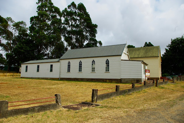
Hamilton is historic town on the Lyell Highway located approximately 70 kilometres from Hobart. The town was named by Governor Arthur, either after Hamilton on the Lower Clyde in Scotland or in honour of his friend William Henry Hamilton. From the time of the town’s settlement in the 1820’s only two churches have been established; St Peter’s Anglican church and St Stephen’s Catholic church. The latter has closed in recent years. In fact, two Catholic churches were built at Hamilton, the first opened in 1856 and the second in 1958.  Hamilton’s Catholic population was once sizeable as attested by the large Catholic cemetery which contains almost 200 headstones. There is little freely available information about the establishment of either of the two Catholic churches. There is no newspaper record of the opening of the first church. In January 1857 The Courier reported that a Roman Catholic Chapel had been erected in Hamilton in the previous year. However in March 1857 the Hobart Town M

No. 650 - Magnet Methodist Church

Image
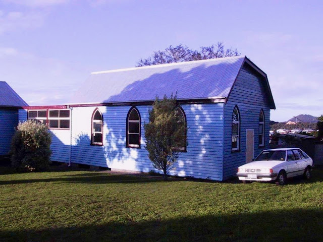
The former township of Magnet is located at the edge of Tasmania’s Tarkine region. It developed around the Magnet Silver Mine in the shadow of the Magnet Mountain range. The settlement was mostly populated by workers from the mine. By the start of the Great War Magnet’s population peaked at about 500 with about 200 men employed in the mines. The township was connected to nearby Waratah by a narrow gauge railway. The area is now a popular fossicking destination and remnants of the settlement can still be found in the bush. One of the best descriptions of Magnet dates back to 1928 although by this time the town was well past its heyday: “Notwithstanding that the township of Magnet has been in existence for a period of over 34 years, it has not assumed any great dimensions in the way of population. It is generally viewed as a very remote village, or, in mining parlance, described as a dead end. The main buildings consist of a very cosy and comfortable public hall that does credit to t

No. 649 - Glen Huon Uniting Church - 'The early ripening of the small fruits'

Image
Glen Huon is a small settlement on the banks of the Huon River approximately 10 kilometres west of Huonville. The area was once a major apple-growing district. The settlement was known as Upper Huon before the 20th century. The first Methodist service in the Upper Huon took place in 1856 when Mr Reeve, a local preacher, came to live on the Rokeby estate situated between Huonville and Judbury. In 1879 the first church was built by Mr Thomason, a ‘Bush Missionary’ on land donated by Mr Jonah Rodman. It was a small building but it served the Methodist community for almost 50 years before it was replaced by the present church which opened in 1928. Fundraising for a larger church began in the early 1920s. The foundation stone for the new church was due to be laid on 21 December 1927 but the ceremony was delayed until February in the following year “owing to the early ripening of the small fruits”. The honour of laying the foundation stone was given to Mrs Mary Voss, who was regarded as

No. 648 - Stowport Uniting Church

Image
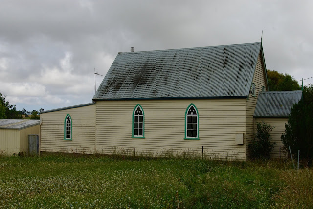
Stowport is a village situated in the hills south east of the city of Burnie. The main part of the settlement is centred around the junction of the Stowport and Upper Stowport Road. It is an area that was first settled by employees of the Van Diemen's Land Company. Stowport’s Uniting Church dates backs to 1889 when it was built as a ‘Protestant Hall’. The original intention had been to build a Primitive Methodist Church at Stowport and in about 1887 a site for a church was offered by Mr Boatwright. However it was suggested that instead a church should be built for use “by all non-conformist bodies” and as a consequence a ‘Protestant Hall” was built and opened in 1889. Launceston’s Daily Telegraph recorded the first public meeting following the opening of the hall in February: “A correspondent writes:— A tea meeting was held in Stowport on Tuesday, 19th inst., to celebrate the opening of the Stowport Protestant Hall. The tables were provided by the following ladies; Mesdames Rut

No. 647 - New Norfolk - St Peter's Catholic Church - "A very necessary clerical appurtenance for the nonce"

Image
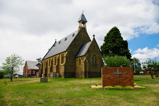
New Norfolk is a historic town on the banks of the Derwent River approximately 40 kilometres west of Hobart. It grew dramatically when settlers from Norfolk Island moved into the district after 1807. When Governor Lachlan Macquarie visited the township he named it Elizabeth Town after his wife. However, it was later decided to adopt the name New Norfolk, to acknowledge the large number Norfolk Islanders. The Catholic presence in New Norfolk predates the St Peter’s Catholic church by over 60 years. The reason for the delay in building a church is largely a result of the poverty of the early the Catholic community, many of whom were assigned convicts or had qualified for a ticket of leave. The first Catholic Mass to be held in the township was performed by Father Philip Connolly in 1821. In the mid 1850s, the former Court House in the High Street was purchased by the Catholic Church for the sum of £450 and was converted for use as a presbytery and chapel. The first permanent priest, Fa

No. 646 - Pinewood Uniting (Methodist) Church - "A work of faith and a labour of love"

Image
The former Pinewood church is situated on Pine Road and almost midway between the town of Penguin and the small settlement at Riana. It is probable that the area was named after the celery top pines that were logged in the once heavily forested district. The Pinewood church is one of a handful of churches in Tasmania that was associated with the United Methodist Free Church, a breakaway denomination from the Wesleyan Methodists. Little information is available about the early years of the church. Methodist services began in the home of the Hooper family soon after the arrival of the first settlers in the late 1860s. The original church was built in 1885 on land donated by George Hooper and the building was erected by Mr Isaac Hall. In 1890 a school, known as the Ashwater school, was built on the western side of the church. The school building was the property of the church and was used as a State school until 1930. The building was used for a Sunday school until at least 1896 when

No. 645 - Mooreville Road Methodist Church - 'Stories in the Stones'

Image
Mooreville is a small settlement situated approximately 5 kilometres south of Burnie. The name of the settlement as well as the road to Burnie was given by a local landholder, Mr James Henry Munce, in the late 1850s. The name comes from a location in England known to him. The Mooreville Road Methodist church is now located on Mount Road in Upper Burnie. After the Waratah Methodist church was removed to Upper Burnie in 1951 for use as a new place of worship, it was joined by the Mooreville Road Church in the 1960’s where it was converted into a church hall. In recent years the old Mooreville church has been clad with Colorbond and in the process its gothic windows have been lost which has completely altered the appearance of the historic building. When the church was moved to Burnie its memorial ‘foundation stones’ were brought with it and these are now one of a few hints as to the refurbished building’s original purpose. One of the foundation stones bears the inscription “In memor