Posts

Showing posts with the label 1910-1919

No. 1082 - Cubit's Creek Meeting House (1911-1956)

Image
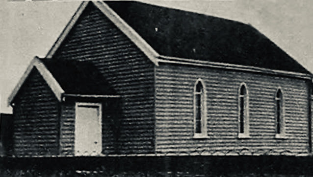
I will be posting a series of very short articles about minor churches that have left little trace in the historical or photographic record. Among the objectives of this blog is to create a definitive catalogue of all churches and other places of worship that have existed in Tasmania since settlement. My hope is that the publication of some basic details about these buildings on this blog might result in further information and historical images coming to light. Cubit’s Creek is a locality in the Caveside district which is close to Mole Creek in Tasmania’s north. Cubit’s Creek Meeting House was the predecessor of the Caveside Church of Christ that was built in 1956. In the 1870s the Church of Christ arrived in Tasmania and first established itself in Launceston and Hobart. Initially the denomination was simply known as the ‘Christians' then from 1885 as 'Disciples of Christ' and finally as 'Churches of Christ'. The Churches of Christ formed numerous congregations ac...

No 1076 - Henrietta Baptist Church (1915-1959)

Image
Henrietta is a rural settlement on the Murchison Highway approximately 30 kilometres south of Burnie. It is situated between the junctions of Takone Road and East Yolla Road. The closest town to Henrietta is Yolla, about 5 kilometres distant. Early Baptist services at Henrietta were held in a house belonging to Mrs Graue. After this services were held in the Henrietta hall which was built in about 1912. In 1914 a visitor passing through the district described the settlement: “We are now on the borders of Henreitta Plain, the extent of which is one thousand acres. Here is also the Henrietta town reserve, the only buildings on which are a small homestead owned by Mr W. Diprose, and a hall erected by Mr S.J. Smith, in which services are held alternatively by the Baptists and Methodists. There are a number of settlers on the plain, but not on the main road…”. In October 1915 the North West Post reported that the Baptist’s had purchased the hall, (which had closed), for £80. An amount of £6...

No. 1057 - Montagu - Our Lady of the Sacred Heart Catholic Church (1910-1973)

Image
Montagu is a small rural settlement approximately 16 kilometres west of Smithton in the far North West of the State. It was established by the Van Diemen's Land Company to house men working on its "Woolnorth" property. The settlement takes its name from the Montagu River, named after John Montagu, Colonial Secretary of Van Diemen's Land from 1834 to 1842. Our Lady of the Sacred Heart Catholic church served the community for over 60 years before its closure in the early 1970s. However the local Catholic community had been active at Montagu from 1870s. The foundation stone for the church was ceremonially laid on Wednesday 24 February 1910; the event being recorded by the North West Advocate and the Emu Bay Times: “For many years the Catholic people of Montagu have stood sorely in need of a church. Services have been held there for the past 40 years at the residence of Mrs. Saward, sen. The local rector, Father. O'Donnell, has, however, decided that the old order m...

No. 999 - Tullah - St Andrew's Anglican Church (1912-1982) - "Not cost one penny"

Image
Tullah is a small town on the Murchison Highway approximately 110 kilometres south of Burnie. It was established in 1900 as a remote mining settlement called Mount Farrell. In the 1970s Tullah was used by the Hydro Electric Commission to house workers engaged in the various parts of the Pieman River Power Scheme. At this time Tullah’s population peaked at 2500. The town is divided into two sections; the older northern mining settlement and the newer southern part developed by the Commission. Four churches were built at Tullah representing the Methodist, Catholic and Anglican denominations. These have all closed and in recent years were replaced by the Tullah Community Church. St Andrew’s Anglican church opened in December 1912 but was only consecrated in the following year. A report in the Mercury records the first service taking place on Sunday 15 December: “The first Sunday service has been held in the new Church of England. The building, which is 37ft. long, is not quite completed...

No. 998 - Myalla Gospel Hall

Image
Myalla is a rural settlement south of Sisters Creek and the Bass Highway. The district was known as Myalla from about 1905 when roads were planned for the area. The railway from Burnie reached Myalla in 1913. At its peak, Myalla had three churches: an Anglican Mission Hall (1919), a Gospel Hall (1919) and a Baptist church (1923). Of these, only the Gospel Hall has survived closure. The Myalla Gospel Hall was officially opened on Wednesday 29 January 1919. A report in the Advocate provides a few details about the occasion: “A large assemblage from all parts of the district, and visitors from Sheffield, Ridgley, Burnie, and Forest, attended the opening services at the new hall which the Brethren have recently erected at Myalla. The hall was crowded at each of the services. Mr. Geo. Atkinson, of Burnie, opened the afternoon service…Mr. Atkinson then led the meeting in prayer, and afterwards spoke at some length on the need for such a building at Myalla, and expressed his pleasure at the ...

No. 987 - Mangalore - St Martin's Anglican Church (1914-1967)

Image
Mangalore is a semi-rural district on the Midland Highway approximately 6 kilometres north of Pontville. It was once a farming area but in recent years it has undergone some suburban development. The area is named after Mangalore Tier, a feature that was first marked on maps in the early 1820s. Very little information is available about St Martin’s and I have yet to find a photograph or a description of the building. Most information about the church’s established comes from a single report published in the Hobart Mercury in November 1913: “During the last four of five years the population of this district has increased so rapidly that the Rev. J. Corvan recently opened a Church of England Sunday-school at the railway station until a suitable building was erected. Mrs Graf gave a block of land (very conveniently situated) to the church trustees, and an energetic committee has been at work endeavouring to raise the necessary funds. A concert, a lecture, contributions in the shape of c...

No. 980 - Glenfern - St Mary Magdalene - Anglican Church (1908-1954)

Image
Glenfern is a rural community about 10 kilometres southwest of New Norfolk. The district was previously known as Dry Creek until the 1880s when a State school and post office were established at the settlement. St Mary’s Anglican church is the only place of worship built at Glenfern. One of the earliest descriptions of the settlement was published in the Hobart Mercury in 1903: “The district known as Glen Fern is situated on the creek of the same name, and extends up the stream for a distance of four or five miles from the State School, which is six miles from New Norfolk, in a westerly direction. The creek is supported on both sides with high ranges, but rich valleys, varying in width, prevail, on which fully two dozen settlers are enabled to make comfortable livings. Most of them combine the two industries of fruit and hop growing, but none of the areas are very large. The only public building is the State School, wherein divine service is conducted occasionally by a Church of Englan...

No. 979 - Crabtree - Salvation Army Hall (1917-1967)

Image
Crabtree is a rural settlement in the local government area of Huon Valley and is located about 15 kilometres north of Huonville. It was once an important timber and orchard-growing district. The settlement is named after the Crabtree Rivulet. Crabtree has had only two places of worship; a Salvation Army hall which was built in 1917 and an Anglican church hall which opened in 1929. The State school was used for religious services by both the Salvation Army and the Anglican’s prior to the construction of the two halls. The activities of the Salvation Army at Crabtree were an extension of the the Corp’s that was established at nearby Ranelagh in the late 1890s. In both settlements, orchard workers were an important source of Salvation Army supporters. The Crabtree hall opened on Saturday 2 June 1917 being built for holding religious services as well as a Sunday school. The hall’s opening was recorded by the Huon Times: “The new Salvation Army Hall was opened on Saturday afternoon… by M...

No. 959 - Claremont - Congregational Church Hall (1915-1963)

Image
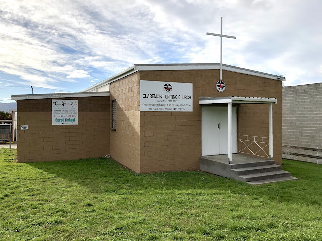
Claremont is a suburb of the City of Glenorchy within the Greater Hobart region. It is named after Claremont House built in the 1830s by Henry Bilton. Claremont was once the site of an army training camp established during the Great War. At this time the area had only a few scattered houses and a railway station in a largely rural setting. From the 1950s public housing was built at Claremont which resulted in significant population growth. The Congregational Church was first active at nearby Hestercombe in the 1830s. In 1911 a site for a Congregational Mission Hall was purchased at a junction adjacent to the Claremont Recreation Ground. From 1913 services were conducted in a private house before being transferred to the Claremont school. The foundation stone for the Mission Hall was ceremonially laid on Wednesday 10 March 1914. The Mercury published a brief report of the event: “The stone of the Congregational Mission-hall at Claremont was laid on Wednesday afternoon by Rev. W. Perr...

No. 936 - Pawleena - The Church of the Holy Cross (1910 - 2002)

Image
Pawleena is a small rural community approximately 6 kilometres north of Sorell. The settlement was originally known as ‘Cherry Tree Opening’ and the name Pawleena appears to have been adopted after 1923. Pawleena is an Aboriginal word, used by southern tribes, meaning 'gun' or musket. Aside from a handful of reports in local newspapers, there is little information about the Anglican Church of the Holy Cross. The church was built in 1910 and dedicated by Bishop Mercer on Wednesday 14 September. A correspondent for the Mercury reported: “In perfect weather on Wednesday, the Bishop of Tasmania dedicated the new Church of S. Cross [sic] at Cherry Tree Opening. The church stands about four miles from Sorell on one of the prettiest roads in the district. A large number of people journeyed from Sorell and the district (reaching to Nugent to Dunalley) to take part in the interesting and important ceremony. The building, which was erected by Mr, Arthur Quinn, is of a size to hold a hun...

No. 929 - Wivenhoe - St Chad's Anglican Church (1919-1974)

Image
Wivenhoe is a suburb of Burnie situated on the east bank of the Emu River. It has developed into an industrialised area less than 3 kilometres south-east of the city centre. In the 1850s the area was named after the town (and parish) of Wivenhoe in Essex County by Captain Henry Butler. Wivenhoe’s former Anglican church stands near the corner of Corcellis Street and Main Road. The building still exists although it is now barely recognisable as a church. Since the church’s closure in the 1970s it has been clad in ‘colorbond’ sheeting and has been shifted to the rear of the corner block. The origins of the church presents a mystery as there are no reports in contemporary newspapers of an Anglican church being built or opened at Wivenhoe. The reason for this is that the building was originally a Presbyterian church hall which opened in February 1915. [ see No. 861 ]. The Presbyterian hall operated for less than four years and in July 1919 it was acquired by the Anglican church. The Emu Bay...

No. 927 - New Town - Roope Street Salvation Army Hall

Image
New Town is a northern suburb of Hobart. It is also one of Hobart’s oldest suburbs and consequently the area contains many historic churches. New Town became a municipality in 1907 but was absorbed into Greater Hobart in the 1920s when its municipal status was relinquished. Roope Street dates back to the 1850s and intersects New Town Road and Pirie Street. It is most likely named after Lavington Roope, a successful Hobart merchant and Vice Consul for Portugal, Denmark, Sweden and Norway. Little information is available about the former Salvation Army Hall located at 16 Roope Street. At present the building serves as commercial premises and in recent years has been used by the Southern Presbyterian Church. What is known is that the Salvation Army hall was opened on Saturday 8 February 1913 by Commissioner Hay and Colonel Knight. Apart from an advertisement in the Daily Post in January 1913, seeking “first-class carpenters” for the hall’s construction, little else is known about the b...

No. 925 - Smithton - Uniting (Methodist) Church (1912-2017) "I might only chop it up for firewood"

Image
Smithton is the commercial and industrial centre of the Circular Head district in the far northwest of the island. The early settlement was known as Duck River but this was changed to Smithton in 1895. Smithton is named after an Irishman, Peter Smith, who had been a constable, and later the licensee of ‘The Plough Inn,’ at Stanley. Smith moved to Duck River after buying some 500 acres of land from the Poke and Ollington families. Smith’s successful enterprises enabled his return to Ireland. The earliest record of Methodist activity at Smithton dates back to 1907 with the establishment of a Sunday school. The first meetings for worship were held in a potato shed, in the State schoolroom, in the open air and in private residences. In April 1910 the Methodists rented Smithton’s Presbyterian church after services were discontinued. In the same month, Reverend W. Bridgeborn was appointed as the first permanent minister. The Methodists had intended to buy St Andrew’s Presbyterian church but...

No. 910 - Forest Baptist Church - "The Carpenter Cleric"

Image
Forest is a small settlement off the Bass Highway about 12 kilometres south of Stanley in Tasmania’s far North West. The early settlers referred to the area as "the forest" and when an official name was needed it became simply “Forest”.  For a time locals referred to the settlement as “Tierney’s Town”. Forest and the surrounding district has been home to numerous churches, most of which have closed and no longer exist.  The settlement at Forest centres on the intersection of Mengha Road and Back Line Road. Three churches were established near this intersection: St Bartholomew’s Anglican church (1905); a Union Church (1894) - now the Forest Christian Centre (Christian Brethren) and a short-lived Baptist church established in 1913. In 1918 a visitor to Forest mentions all three churches: “Now we come upon that pretty, quaint-looking Church of England—St. Bartholomew’s—the inside of which is well worth a visit. It has almost within a stone’s throw two other less pretentious-look...