Posts

No. 1371 - Brittons Swamp - Anglican Church Hall (1943)
Image
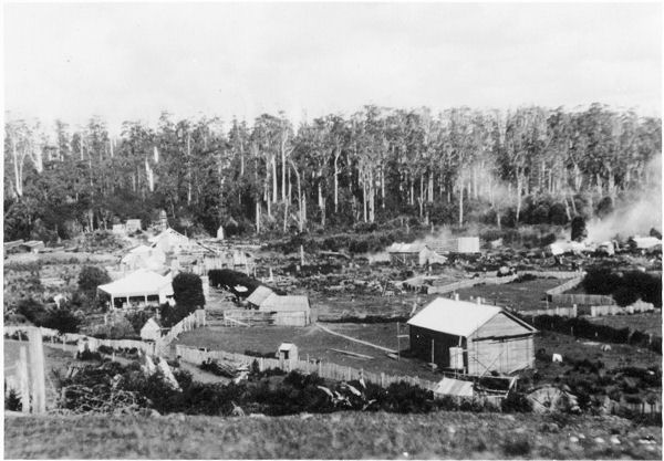
This ‘blog entry’ is one of a series of short articles about places of worship that are barely represented in the historical record. Often no images of these buildings have survived. My hope is that these brief articles may result in further information and photographs coming to light enabling a more complete history of Tasmanian churches. Brittons Swamp is a settlement on the Bass Highway approximately 20 kilometres west of Smithton. It had its beginnings as a saw-milling area established by the Britton family. Later the government used the area as a soldier settlement housing returned soldiers on small farms. In August 1943 the Circular Head Chronicle reported that “a small hall was built at Britton’s Swamp for services”. This development followed the establishment of an Anglican Sunday school in 1941 which had an enrolment of 25 pupils. In 1951 the Chronicle reported that an organ was donated to the ‘Church of England’ at Britton’s Swamp and “had been installed”. I have found no fur...

No. 1370 - Brighton - Immaculate Heart of Mary Catholic Church (1957-1984)

Image
Bridgewater is situated on the eastern shore of the Derwent River and is a suburb of the Municipality of Brighton. A large Housing Department estate was built on the eastern side of the Midlands Highway between 1970 and 1980. The older part of Bridgewater dates back to the 1830s when a causeway was built across the Derwent. The Immaculate Heart of Mary Catholic Church was previously used as a ‘Catholic Soldier’s Hut’ at Brighton Military Camp. The prefabricated building, which was erected at the camp in 1940 was also used as a place of worship. [see No. 1145 ] In 1957 the building was relocated to a site on Brighton Main Road near the causeway and bridge. In 1967 the church was almost lost to bushfires which swept across Southern Tasmania. The temporary church was used for almost 30 years before it was replaced by St Paul’s Catholic Church which was built within the new housing estate. After the old church’s closure in 1984 the building was demolished. Immaculate Heart of Mary Catholic...

No. 1369 - Gardners Bay - St Barnabas' Anglican Church (1894)

Image
Gardners Bay is rural community approximately 8 kilometres south of Cygnet on the Woodbridge Hill Road. The settlement takes its name from a bay south of Cygnet. The origins of St Barnabas’ Anglican church dates back to November 1893 as reported in the Tasmanian News: “Members of the Church of England are about to build a church at Gardner’s Bay. Great credit is due to Mrs Thomas Nichols and Mrs Cockerill for the active steps they have taken in providing the necessary funds for this good purpose”. There are no published records of the church’s opening in October 1894 however the role of Mrs Sarah Nichols in establishing the church was acknowledged by Bishop Montgomery who wrote: “Dear Mrs Nichols, — I must write you a line before I go, telling you how thankful I am to you for what you and your husband have done for Gardner's Bay. The building which you have been instrumental in erecting will be a great blessing. It may preserve the whole neighbourhood to the church, and ...

No. 1368 - Nugent - St Andrew's Anglican Church (1901)

Image
Nugent is a rural district approximately 15 kilometres south of Buckland and north of the Arthur Highway. The area was once known as Carlton Scrub. The origins of the name ‘Nugent’ is not known but this was adopted as the name of the district’s State school built in 1878. Nugent’s Anglican church was closely associated with Mr Thomas Blackmore who was elected as churchwarden in 1882. At this time religious services were held in the State school. in 1898 a report in the Hobart Mercury described a social gathering held to raise funds for a church: “A pleasant social was held on the 28th ult., in Mr. Blackmore's barn, kindly lent for the purpose, in aid of the proposed Nugent church, but owing to bad weather, the attendance was somewhat small. A good supper was provided by the ladies of the district. Mrs. Blackmore kindly lent her piano, and in addition, a melodeon and violin were secured. Songs were sung by Mrs. Olden, Miss Cornish, and Messrs. Briton and Cornish. The elderly people ...

No. 1367 - Cradoc - St Peter's Anglican Church (1921)

Image
Cradoc was once an important orchard-growing district on the Channel Highway. It is situated about 10 kilometres south of Huonville and lies on the eastern bank of the Huon River. The foundation stone for the St Peter’s Anglican church was ceremonially laid on Saturday 31 July 1920. The Huon Times published the following report of the event: “On Saturday afternoon last the Vicar General of the Diocese, Archdeacon Whitington, laid the foundation stone of a new Anglican Church to serve the people on the Cradoc side of the river. It is proposed to erect the first part of the church at present, adding an apsidal chancel and vestry later….The Rector and Rural Dean, Rev. A. G. Cutts, made a brief statement of the history of the movement and explained that the land was the gift of Mr. W. H. Beechey. The Vicar General duly laid the stone and in addressing the company congratulated the residents, and as the chief official of the diocese, thanked the donor of the site….A collection was placed on...

No. 1366 - Torquay (East Devonport) - St Mary's Church and School (1863)

Image
Before the official proclamation of the town of Devonport in 1890, two seperate townships developed on either side of the Mersey River; Torquay on the east and Formby on the west. Of the two towns Torquay was initially the most developed. East of Torquay farmers settled along the coast from North Down to Port Sorrel and in 1851 the discovery of coal at Tarleton initiated a period of growth for the town. Provision was made for an Anglican Church at Torquay in 1853, two years after the township was surveyed. Six acres of land was reserved for a church, rectory, school and burial ground. The earliest report of an Anglican service at Torquay is recorded in The Colonial Times which mentions Bishop Nixon preaching there in November 1854. In the early 1860s a Music Hall was leased for “church and [Sunday] school purposes”. Early efforts to build a church were met with delays. In March 1861. The Cornwall Chronicle reported: “The erection of a Place of Worship for Members of the church of Engla...

No. 1365 - Launceston - St John's Mission and Shoobridge Hall (1906)

Image
St John’s Mission was established in 1893 in response to a growing number of families living in extreme poverty. The arrival of the Salvation Army in Launceston in the early 1880s and its relentless proselytising amongst the town’s poor challenged the established churches to respond to both the spiritual and material needs of the poor; especially those who had abandoned the practice of religion. During the incumbency of the rector of St John’s Church, Reverend Cannon R. C. Nugent Kelly, an Anglican mission was opened in a former public house, the ‘Queen’s Head’. The building, which no longer exists, was located in the vicinity of the Coles Supermarket car-park on Wellington Street. The driving force behind the establishment of the ‘Queens Head Mission’ was Charlotte Shoobridge, better known as “Sister Charlotte”. In 1894 Sister Charlotte was ordained a ‘deaconess’ of the Church of England, the first ‘deaconess’ in Tasmania. In 1892 Sister Charlotte moved to Launceston to take on the c...

No. 1364 - Kellevie - "The Christian's Chapel"

Image
Kellevie is a small settlement about 10 kilometres north of Copping. It is situated at the junction of Kellevie and the Bream Creek Roads linking the Arthur and the Tasman Highways. The district was known as the Ragged Tier and Kellevie was previously known as Upper Carlton. The history of Kellevie’s settlement is outlined in an article published in the Hobart Mercury in 1929: “How and when Kellevie first received its name the writer does not know, but its development seems to have been contemporaneous with the other two districts of the Ragged Tier, Bream Creek, and Copping, which began in earnest in the eighties, when the hard work of pioneering a wilderness of giant blue gums (some nine feet in diameter and of immense height), wild pear, musk, lightwood, dogwood, and other forest trees, with almost impenetrable undergrowth was beginning to reap its just reward. In connection with the accomplishment of this great enterprise the names of Freeman, Brown, Tunbridge, Corbett, Woolley, Ki...

No. 1363 - Rocky Cape - St Aidan's Anglican Church (1908)

Image
Rocky Cape is a rural settlement on the Bass Highway located about 30 kilometres north-west of Wynyard. The name Rocky Cape is taken from a prominent coastal feature described by Matthew Flinders in 1798. St Aidan’s Anglican church was built and dedicated in 1908. It was located near the junction of Montumana Road and the Bass Highway. The church burnt down in the late 1980s and was not rebuilt. I have yet to locate a photograph of the church and I have used a photograph of the Rocky Cape public hall to illustrate this article. The hall was used for church functions for many years. The ceremonial laying of the foundation stone of St Aidan’s took place on Friday 22 May 1908. The event was described in a report published by Launceston’s Daily Telegraph: “Last Friday afternoon, the laying of the foundation stone of the new Anglican church was performed by Archdeacon Whitington….in the presence of a large assembly, the weather being most propitious for the occasion. The ceremony was carrie...

No. 1362 - Hobart - The Helping Hand Mission (1894)

Image
The Helping Hand Mission was an evangelical church active in Hobart for a period of a little over 40 years. It was founded in 1894 by Mr Sydney Cummins, a prominent Hobart businessman and lay-preacher. Cummins was one of the first members of the Salvation Army in Hobart and a leading figure in the temperance movement. The Mission's evangelical style of worship combined with its message of temperance and Christian action was directed at the poor and those on the margins of society. In the Mission’s first year meetings were held at a number of venues including the People’s Hall; the YMCA rooms; the Temperance Hall; the Mechanics Institute and the King Street (now Pitt street) Undenominational Church. In November 1895 the Helping Hand Mission united with the Central Hobart Mission to form the “Evangelistic Helping Hand Mission”. In August 1896 the Mission leased a warehouse on Watchorn Street (then known as Central Street) which was converted into a Mission Hall. The Hobart Mercury...

No. 1361 - Hobart - Jane Franklin Hall - Non-denominational Chapel (1960-1970)

Image
Jane Franklin Hall was an independent non-denominational residential college of the University of Tasmania. It is situated on Elboden Street, South Hobart. It was founded by the Tasmanian Council of Churches in 1950 as a residential college for women before becoming co-educational in 1973. The College adopted the name of Jane Lady Franklin who was an enthusiastic patron of the arts and education. Her husband was the famous but ill-fated arctic explorer Sir John Franklin, who was the sixth Lieutenant-Governor of Van Diemen's Land. The College was a non-denominational Christian institution supported by chaplains of various churches. Religious services were held on a verandah before a chapel was built in 1960. The chapel, an unpainted wooden Scandinavian style building, was designed by Dr. Edith Emery. Jane Franklin Hall no longer has any association with the Christian tradition. The Chapel was removed to Baden in 1970. I have been unable to find a photograph of the chapel before it...

No. 1360 - Ringarooma - St Martin of Tours Catholic Church (1882-1890)

Image
This ‘blog entry’ is one of a series of articles about places of worship that are barely represented in the historical record. Often no images of these buildings have survived. My hope is that these brief articles may result in further information and photographs coming to light enabling a more complete history of Tasmanian churches. Ringarooma is a small rural town in northeast Tasmania. It was once known as Krushka, after Christopher Krushka, a German migrant and local landowner who, with his brother Charles, had prospered from tin mining in the nearby Derby district. Ringarooma’s first Catholic church, St Martin’s of Tours, was in use for only 8 years before it was destroyed in a fire in October 1890. St Martin’s was opened on Sunday 17 December 1882. A report in the Launceston Examiner provides some information about the church and its origins: “The Roman Catholic Church at Ringarooma, dedicated to St Martin, was used…for the first time, mass having been periodically celebrated in...