Posts

No. 970 - Smithton - St Peter Chanel Catholic Church

Image
Smithton is the commercial and industrial centre of the Circular Head district in the far northwest of the island. The early settlement was known as Duck River but this was changed to Smithton in 1895. Smithton is named after an Irishman, Peter Smith, who had been a constable, and later the licensee of ‘The Plough Inn,’ at Stanley. Smith moved to Duck River after buying some 500 acres of land from the Poke and Ollington families. Smith’s successful enterprises enabled his return to Ireland. The first Catholic churches in the Smithton district were built at Irishtown (1903) and Montagu (1910). St Attracta’s Catholic church at Smithton was built in 1934 at a site on Emmett Street [see No. 903] In the late 1970s the church with its associated convent school moved and reopened at a new site at Sampson Avenue on Tier Hill. The new church was dedicated to St Peter Chanel, a Marist priest who was martyred on Futuna Island in 1841, and who was to become Polynesia's only Catholic saint. St...

No. 969 - Adamsfield - Ministering on the "Ossyfield"

Image
Adamsfield was an isolated mining settlement situated in the rugged southwest, approximately 10 kilometres west of the Florentine Road and about 5 kilometres from Lake Gordon. Now a ghost town, it was established when rich deposits of osmiridium were found at Adams River Field in the 1920s. At this time osmiridium had a value of about £30 per ounce; several times the value of gold. A mining rush began in 1925 and a camp of about 1,000 people emerged. By the late 1930s the rush was over and by the 1960s commercial mining activity had ceased altogether. At its peak Adamsfield’s population was sizeable and the township had a community hall, post office, a field hospital, a school and a handful of shops. Although no churches were established, religious services were held in the community hall. Most of Tasmania’s early mining settlements invariably had at least one church established but Adamsfield’s remote location and the short duration of its population peak, mitigated against a permanen...

No. 968 - Glenorchy - St John the Baptist Catholic Church

Image
The city of Glenorchy is located approximately 7 kilometres north of Hobart's CBD. Glenorchy means ‘glen of tumbling waters’ and it is believed that Governor Lachlan Macquarie named the area after his wife’s birthplace; Glen Orchy, Argyllshire.The district was originally named 'King Georges Plains and the first centres of settlement were previously known as 'Kensington (Village)' and ‘O'Briens Bridge’. St John the Baptist Catholic church is located at the head of Regina Street. It is the second Catholic church built at Glenorchy. Opening in 1960, it replaced a sandstone church on the Main road, built in 1859, which was also dedicated to St John the Baptist. [ see No. 939 ] With the rapid growth of Glenorchy after World War Two, the old church had to accomodate up to five Masses each Sunday. On occasion worship had to be held outside to accomodate parishioners. It was these circumstances that led to the construction of a new church in 1960 on a site off Bowden Str...

No. 967 - George Town - Salvation Army Hall

Image
George Town is one of the oldest towns in Australia and is the second oldest town in Tasmania. It is therefore unusual that most of the town’s churches were only established after World War Two. The emergence of Launceston as the administrative centre of the North in the early years of the colony meant that George Town was destined to remain a backwater until more recent times. The construction of an aluminium smelter at nearby Bell Bay in the 1950s as well as the development of industry south of the town, accelerated George Town’s population growth in the post-war era. George Town’s Salvation Army Corp is located is located in Sorell Street. Two buildings stand on the site; a weatherboard hall, which accommodates a ‘thrift shop’ and a more recent cement brick hall which is a place of worship. In 1953 George Town’s Methodist Church was moved from Bathurst Street to the Sorrel Street site. A hall (now the Salvation Army thrift shop) was built alongside the re located church. The Metho...

No. 966 - North Hobart - "High Street" Wesleyan Methodist Chapel (1839-1905)

Image
The suburb of North Hobart, as the same suggests, is on the northern fringe of the city. It has evolved into a mixed residential and commercial area since it was developed in the 1830s. The lower end of Tasma Street (formerly High Street) was laid out in the late 1830s with the land on either side subdivided and granted to numerous settlers. In 1839 a Wesleyan chapel and Sunday school was opened on a site at 10 Tasma Street, close to the intersection with Argyle Street. The chapel’s site is now occupied by a warehouse. The chapel owes its existence to a quarrel and short-lived split amongst the Wesleyans. The High Street Chapel is also closely associated with the Swan Street Uniting Church which replaced it in 1905. When the chapel and its Sunday school opened in1839, it was one of eleven Sunday schools in Hobart: three Anglican; one Presbyterian; two Independent; three run by the Wesleyan Society and two by the Wesleyan Association. In 1838 a disagreement within the Methodist Church r...

No. 965 - Rocherlea - The House of Prayer Bible Fellowship International

Image
Rocherlea is an outer northeastern suburb of Launceston. The area was previously known as Rocher’s Lane, which was the location of Rocklands, a house built by Charles Rocher, a barrister of the Supreme Court. The suburb was developed in the 1960s with the construction of public housing. The House of Prayer Bible Fellowship International is a non-denominal church located in a former supermarket on Blackwood Drive. The church was founded by Pastor Abdul-Karim Kamara. The congregation met at a number of locations before it found a permanent home at Rocherlea in 2015. A feature of the church is its multicultural character with members of the congregation drawn from across the globe and this is reflected in the church’s name.  Additional information about this church is welcomed as all articles are continually updated. I can be contacted through this page or my Facebook page "Churches of Tasmania" which is linked here: Churches of Tasmania . Sources and links: The Examiner, Sunday...

No. 964 - Moonah - Fleet Street Seventh-day Adventist Church

Image
Moonah is a suburb of Greater Hobart and is located approximately 5 kilometres north of the central business district. Moonah was previously known as South Glenorchy before it was developed as a residential area in the late 19th century. Moonah’s Seventh-day Adventist church was located on Fleet Street, which is now dominated by businesses and warehouses. The church and its school was once an important centre of the Seventh-day Adventist church and formed an important role in the denominations history. The Seventh-day Adventist Church was established in Tasmania in 1888. The denomination originated in the USA in the 1860s and in 1885 a group of Adventists travelled to Australia and began preaching in Melbourne. After a church group was established in Melbourne in 1886 members moved on to Sydney, Adelaide and Hobart. Public tent meetings were held in Sandy Bay in 1888 which led to the establishment of a church at Collinsvale and then Hobart and Launceston shortly after the start of the...

No. 963 - Claremont - Edge Anglican Church (St Alban's)

Image
Claremont is a suburb of Greater Hobart. It is named after Claremont House, which was built in the 1830s by local settler Henry Bilton. Claremont was the home of an Army training camp during the Great War which at that time consisted of only a few scattered houses in a largely rural setting. Claremont’s first Anglican church, which was built in 1913, was replaced by the present church on a new site in 1981. The original building still exists but has been converted into a house. [ see No. 718 ] In 2016 St Alban’s was renamed as ‘Edge Anglican Church’ in association with St Matthew’s at New Norfolk and St Mark’s at Pontville; which form “a network of Anglican churches in the evangelical charismatic tradition”. The original St Alban's - source: Libraries Tasmania.

No. 962 - Claude Road Methodist Church (1890-1974) - "The Church in the Greenwood"

Image
Claude Road is a rural settlement approximately 10 kilometres south of Sheffield centred on the Dasher River. The area has some history of some mining but logging was once a significant industry. The settlement once had a Methodist Church but the only tangible reminder of its existence is the Claude Road Cemetery. The church opened in 1890 although Methodist services had been held in homes prior to this. A correspondent writing to the Colonist in September 1890 provides a rich source of information about the church’s establishment: “…About five or six miles from Sheffield, on the road to Middlesex, you pass over the Dasher Bridge, and here, along and around the valley of the Dasher, a settlement has gradually been forming and rising into more notice and importance. ….For some years past services have been held in connection with the Wesleyan Church, and I think it has been in connection with those services that the name of Claude-Road has gradually been assumed and adopted. On Sunda...

No. 961 - George Town - Kingdom Hall

Image
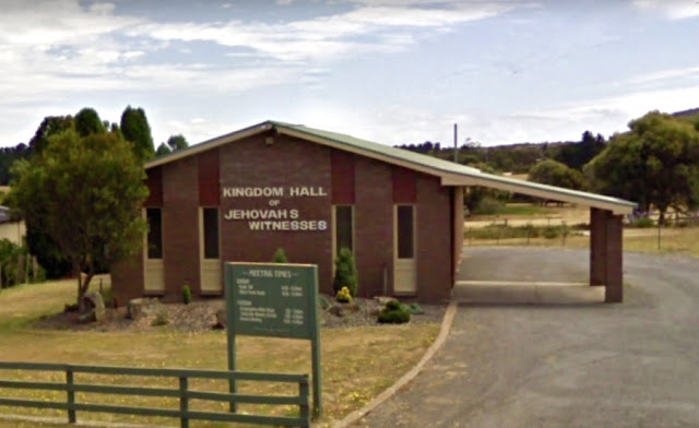
George Town is one of the oldest towns in Australia and is the second oldest town in Tasmania. It is therefore unusual that most of the town’s churches were only established after World War Two. The emergence of Launceston as the administrative centre of the North in the early years of the colony meant that George Town was destined to remain a backwater until more recent times. The construction of an aluminium smelter at nearby Bell Bay in the 1950s as well as the development of industry south of the town, accelerated George Town’s population growth in the post-war era. George Town’s Kingdom Hall is located on the Main Road on the outskirt of the town. It is built in the typical style of most of the 21 Kingdom Halls found in the State. No published information about the hall is available. The Jehovah's Witness diverges from the mainstream doctrines of Christianity in that it is a non-trinitarian tradition. Jehovah's Witnesses believe their denomination is a restoration of first...

No. 960 - Stanley - Our Lady Star of the Sea - "Eclipsed all Expectations"

Image
Stanley is a historic town on the northwest coast approximately 80 kilometres west of Burnie. The Van Diemen's Land Company once had its headquarters here when it was originally known as Circular Head. The settlement was later named after Lord Stanley, the Secretary of State for the Colonies, who went on to serve three terms as British Prime Minister. Stanley has had four Catholic places of worship: Edward Curr’s Chapel at Highfield House (1838); a timber church (1850); a brick church (1897) and the present brick church (1931). The first two churches, both called ‘Our Lady Star of the Sea’ have been featured in previous articles in Churches of Tasmania [see No. 886 and No.932 ] This article’s focus is on the present church which was opened in 1931. Stanley’s second Catholic church, which was used for a little of 30 years was demolished in October 1930. The reason for the building’s demolition and replacement with a new church is revealed in an article published in the Advocate: ...